Terrain Bits
There are lots of programs that deal with terrain (synthetic and otherwise). Some examples are:
|
|
Program |
Operating System |
Description |
|
Windows 9x/Me/NT/2000/XP |
Very nice 3D terrain visualization and flyby animation generator. Also allows translation to other file formats to let you use its data in other programs. |
||
|
Windows 9x/Me/NT/2000/XP |
Generates synthetic terrains and has some limited support for real-world data file input. Has fairly good support for map projection visualization and allows image overlays. Mostly a CC2 map generator program, but has a fair number of other nice features. Windows 9x/Me/NT/2000/XP compatible. I like it because I wrote it, of course… |
||
|
|
Windows 9x/Me/NT/2000/XP |
A nice program from Geomantics (was Visual Explorer from Woolleysoft). Its stock in trade is 3D landscape visualization. Includes the ability to perform raster map overlays on the DEM data that it draws in 3D. Also does nice photorealistic-style rendering. |
|
|
|
MS-DOS and Unix |
Uses a great Inverse Fourier transform generation technique that gives beautifully tilable, seamless terrains. Handles lots of output types including PNG and PGM. |
|
|
|
Windows 9x/Me/NT/2000/XP |
More of a heightfield editor than a terrain management thing, it has simple tools for editing height fields and can read/write many common image formats. |
|
|
Windows 9x/Me/NT/2000/XP |
A DEM merger and displayer. Many nice features including conversion. I will admit I always found it a bit baffling but I expect that’s because I was working with older versions and didn’t spend a lot of time reading the documentation. |
||
|
Windows 9x/Me/NT/2000/XP Macintosh |
An amazing synthetic world generator. Lots of spiffy toys. Go see the site. |
||
|
|
Windows 9x/Me/NT/2000/XP Macintosh |
A renderer that generates spectacularly realistic images of terrains. The newer commercial versions are getting better and better. |
|
|
|
MS-DOS |
A rather elderly program that generates synthetic terrain using the classic plasma algorithm. Handles GIF terrain files for input and output. Has direct sample-level editing and global manipulation features. |
|
|
|
Windows 9x/Me/NT/2000/XP. |
The classic landscape visualization program. The current version has moving water and other visual enhancements. Still lacks much in the way of drawing tools, but that's not surprising - it's for viewing, not making. |
|
|
|
Windows 9x/Me/NT/2000/XP. |
One of my earlier efforts, this one generates synthetic terrains using plasma or procedural texture algorithms. Has direct sample-level editing and global manipulation features. Can read data in USGS DEM format, generic binary format (you specify the data), and others. Outputs in DXF and in various image formats. |
The Terrain Page has a lot of links and good info on terrain generation algorithms. It also has some online examples of the algorithms, including little java applets (with source).
But what good are even the best programs without some data to run them? Here are some sources for data from the world we live upon:
90 meter resolution 1 degree chunks for the United States (USGS DEMs) The USGS keeps the whole United States here. The DEMS are large and ungainly (about 9 MB of text when uncompressed), but are usually pretty good. Wilbur supports reading this file format directly.
1 km resolution data for the world's land masses (Binary data) The whole world can be had from the USGS these days, though at considerably less resolution than the United States. The whole world is stored in a set of 33 tiles, representing the land areas of the world. The data ranges from sparse (the compressed files are less than 1 MB) to dense (the compressed files are upwards of 25 MB). Use the Binary data type to load into Wilbur. Doug Fortune has reduced resolution versions of this entire data set available on his page at http://www.cuug.ab.ca/~fortuned/dew.html. Includes a 4320x2160 16-bit dataset (10 km resolution) version. There aren't any ocean basins, but that's why the following link is provided:
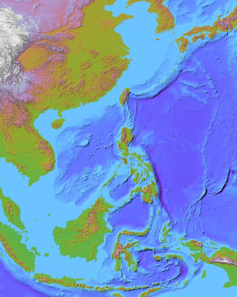
10 km data for whole world including ocean basins (Binary data) The Terrainbase data set has problems in certain areas, but it does contain at least some data for the ocean basins of the world. The software also conveniently provides a way to read in the Terrainbase data (or any other 16-bit Intel-format database that's 4320x2160 samples) to fill in holes in other coverage. I've used the 1 km data combined with the Terrainbase ocean data to make some stunning images of bits of the world. (A large jpeg of part of the far east is given by way of example). There's also a short tutorial that shows how to combine the GTOPO30 data with the Terrainbase data. The link above gives a page that lets you download portions of the data set. You'll need to determine the resolution of that data for use with Wilbur. The full-resolution data set is available at ftp://ftp.ngdc.noaa.gov/Solid_Earth/cdroms/TerrainBase_94/data/tbase.bin. But remember, it's 18.2 MB.
MOLA SCIENCE INVESTIGATION has links to data of Mars from the recent Mars Orbiter project at NASA. The highest resolution data set is 1/16 degree resolution, which works out to around 4 km per pixel at the equator (Mars is much smaller than earth).
<>The Shuttle Radar Topography mission ran back in
February 2000. Its data is now available all over the Internet at
varying resolutions. http://www.dgadv.com/srtm30/ is a pretty front end to the GTOPO30 data
updated with the new SRTM data (available at ftp://e0dps01u.ecs.nasa.gov/srtm/srtm30 if you're interested).
http://www2.jpl.nasa.gov/srtm/ is the official SRTM home site. It has
links to the available 30 meter data for the US (8 GB so don't try to
download it all at once).
Updated 27 Dec 2004